1. The Need for Real-Time Location Systems (RTLS) in Manufacturing Environments
The Challenge of Asset Visibility in Complex Manufacturing
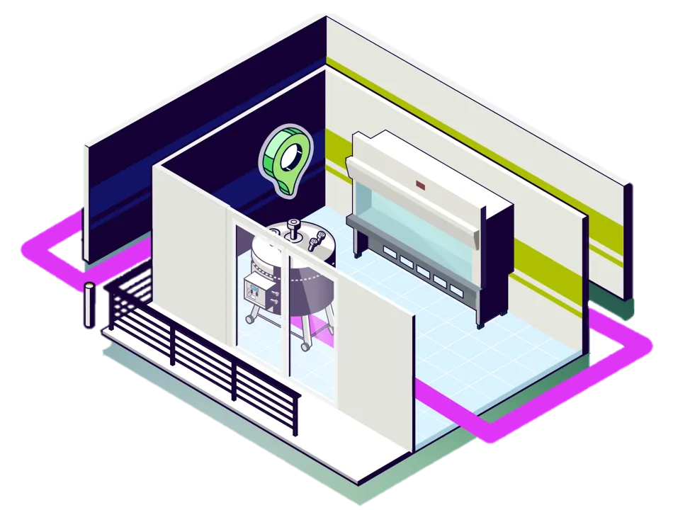
Modern manufacturing facilities are complex environments with high-value operations and stringent regulations. Many processes involve mobile equipment moving between production areas. Examples include IBCs, totes, single-use mixers, and calibration standards that travel throughout the plant. Tracking these critical assets with manual logs or occasional barcode scans often leads to inefficiency and compliance risks.
When assets can’t be seen in real time, equipment often ends up under-utilised or duplicated unnecessarily. A robust asset tracking system has therefore become a practical cornerstone of digital transformation in manufacturing, driving efficiency while supporting GMP compliance.
What is an RTLS and its Role in Operational Excellence
Real-Time Location Systems (RTLS) are technologies that automatically identify and track the location of assets as they move around your site. They typically use small wireless tags attached to assets, a network of receivers, and a software “location engine.” Together, these components create a live digital location of operations and its assets.
Deploying an RTLS in manufacturing brings several benefits. It immediately enhances operational efficiency by showing exactly where assets are, enabling teams to quickly resolve bottlenecks or locate missing items. It streamlines work-in-progress (WIP) tracking in multi-stage processes, ensuring the right components are in the right place at the right time to keep production on schedule and reduce delays.
2. Wirepas Mesh - an RTLS for Manufacturing
What is Wirepas?
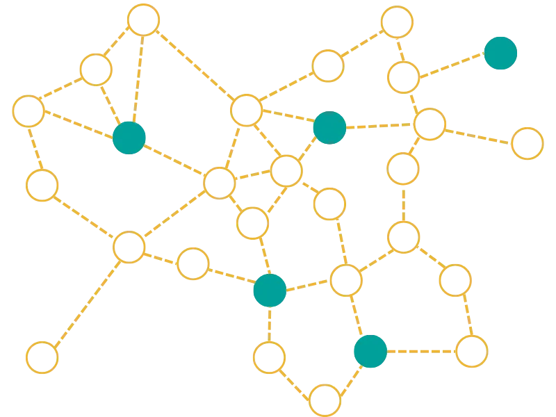
Wirepas Mesh is a decentralised wireless networking protocol, purpose-built for large-scale Internet of Things (IoT) deployments. Unlike conventional networks that depend on fixed access points or central controllers, Wirepas allows each device (node) to form connections with its peers. In essence, the network builds itself: as you add more Wirepas devices, they automatically connect and extend the mesh coverage. This technology runs on standard low-power radio chipsets and supports multiple frequency bands – including 2.4 GHz, sub-GHz, and even a new 5G (NR+) mesh profile.
Core Technical Principles of Wirepas Mesh
Wirepas Mesh employs several key technical principles to ensure reliability, scalability, and efficiency:
Self-Healing and Reliable: There is no single point of failure. Every node can route data for others, so if one path is blocked or a device goes down, the data automatically finds another route through the mesh. This multi-hop resilience ensures the network stays up and maintains near-100% data delivery even if some nodes or a gateway fail.
Dynamic Roles & Power Optimisation: Devices autonomously decide whether to act as routers or remain as end nodes. For example, fixed anchors can stay continuously active to carry traffic, while mobile asset tags conserve energy by waking only periodically. This dynamic approach maximises battery life (asset tags can last several years) without sacrificing coverage.
Adaptive Spectrum Usage: Wirepas automatically hops between channels and uses short, time-slotted transmissions to minimise interference. Each node selects the least crowded radio channel for each communication and adjusts its transmission power as needed. This efficient spectrum management allows very dense networks to operate reliably. It also enables the Wirepas network to coexist alongside Wi-Fi and other wireless systems without causing or succumbing to interference.
Security and Data Integrity
In regulated industrial settings, security is paramount. Wirepas Mesh uses end-to-end AES-128 encryption on all messages, preventing unauthorised devices from interpreting the data. Network credentials (keys) are unique to each deployment, so only authorised nodes can join and communicate. This ensures sensitive operational data remains protected and the system cannot be compromised by outside devices.
3. The Strategic Advantage of Wirepas in Manufacturing
Minimal Disruption to Existing Infrastructure
Wirepas RTLS is ideal for brownfield sites because it requires no new wiring. The entire tracking network – both anchors and tags – runs on replaceable batteries, so it can be deployed with almost no intrusion or downtime. Anchors are simply mounted in place (using adhesive pads or brackets) without pulling cables. For GMP-regulated facilities, avoiding new cabling is a major advantage, as it sidesteps disruptive construction work and any need to re-validate areas of the plant.
Lower Installation Cost and Faster Deployment
By removing the need for cabling and complex integration work, Wirepas significantly reduces the cost and time needed to set up an RTLS. In fact, some projects have reported installation costs up to 90% lower than a conventional wired system. A deployment that might take months with other technologies can often be completed within days or weeks using Wirepas. This rapid time-to-value means manufacturers begin seeing the benefits almost immediately.
Meeting GMP and Environmental Requirements
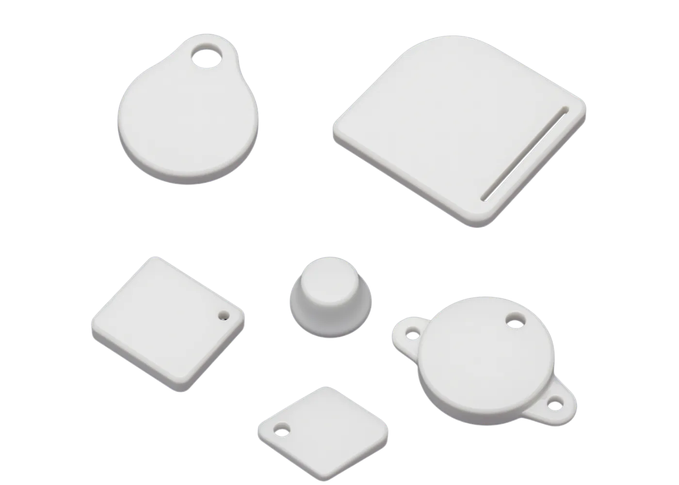
Rugged, Cleanable Hardware: Wirepas tracking tags and anchors are built for industrial use. Many come in rugged housings with high IP ratings (up to IP67/IP69K) and are made of materials like polypropylene, so they withstand regular wash-downs and strict cleanroom protocols. You don’t have to worry about tags contamination or failing after exposure to cleaning chemicals.
Hazardous Area Compliance: For sites with explosive atmospheres or solvent handling (ATEX/IECEx zones), Wirepas supports certified intrinsically safe tags (for example, an EX-rated Wirepas tag model is available). This allows you to track assets seamlessly across the entire facility – even in hazardous zones – without special accommodations or separate tracking systems.
Right-Sized Accuracy vs Other Technologies
Wirepas Mesh offers a practical balance of accuracy and cost for asset tracking. Its positioning engine typically locates tags within about 3–5 metres. In most cases, this “sub room-level” accuracy is sufficient to know which area or floor an asset is on, enabling the vast majority of use cases in production or compliance (such as finding equipment or verifying if an item is in the quarantine area).
By contrast, ultra-wideband (UWB) systems can achieve sub-meter accuracy (down to 10–30 cm) but require a dense network of wired receivers and costly tags – an impractical choice for covering a large, multi-building site. Wi-Fi-based locating can use existing access points, but it usually only offers 5–10 metre accuracy, specific wi-fi infrastructure, and drains tag batteries quickly (meaning tags need frequent recharging or replacement).
With Wirepas, you get reliable sub room-level tracking that scales to thousands of assets, with minimal infrastructure and long battery life. This makes it economically feasible to tag not just the highest-value equipment, but even moderately priced assets that you simply cannot afford to lose or misplace.
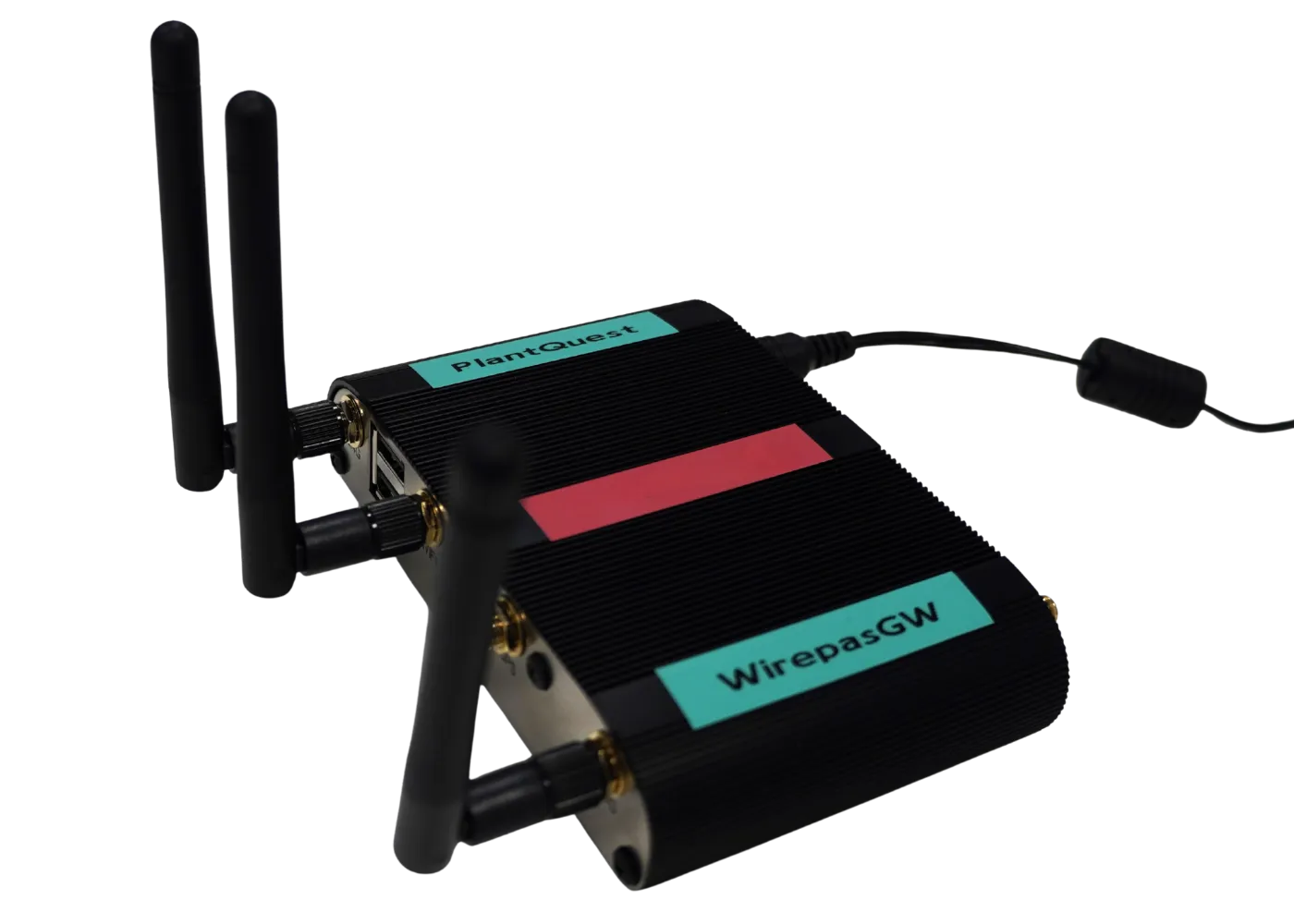
4. Wirepas RTLS System Architecture and Hardware
Key Components: A Wirepas tracking solution consists of three main hardware elements – tags, anchors, and gateways – coordinated by a back-end positioning engine (software). The table below summarises their roles:
Mobile trackers on assets
Broadcast ID & signal strength; can include sensors and receive commands (e.g. blink/beep)
Battery life of typically 2–5 years
Attached to moving equipment
Relay data from tags (multi-hop); measure signals for positioning
Battery life of typically 10+ years
Mounted on walls or ceilings (no wires)
Collect data from the mesh and sends to server/cloud
Typically 1 per floor or building (Ethernet/Wi-Fi backhaul)
Asset Tags
Asset tags are small battery-powered devices attached to each asset. They periodically broadcast their identifier and signal strength, allowing anchors to detect them. With configurable “chrup” or reporting periods, each tag can be optimally configured depending on the asset being tracked.
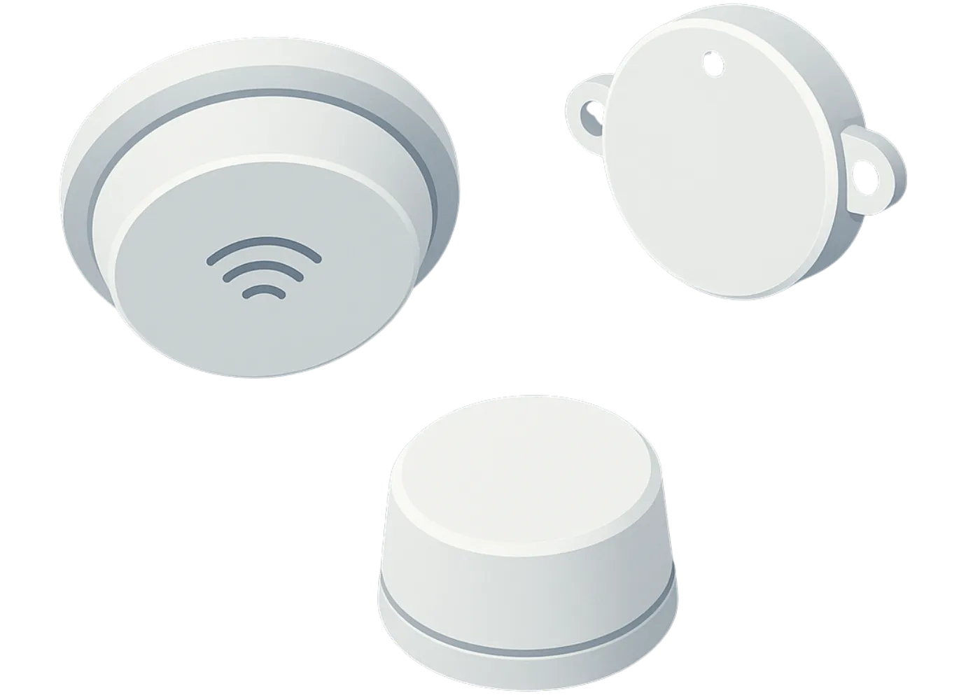
Anchors
Anchors are fixed nodes that create and sustain the mesh network. Each anchor listens for tag signals and relays that information “hop-by-hop” toward a gateway. Anchors communicate with one another, forming a resilient, self-healing web across the facility. As they run on replaceable batteries and require no cabling, anchors can be placed wherever coverage is needed – typically high on walls or ceilings for the best range. They act as both reference points for calculating tag locations and as routers, ensuring data finds a path to a gateway even if some nodes go down.
Gateways
Gateways link the wireless mesh to the central system. A gateway contains a Wirepas radio module (sink) that gathers data from the nearby anchors, and a backhaul connection (Ethernet, Wi-Fi, or 4G/5G) to send that data to the positioning engine (server or cloud). If one gateway is offline, the mesh will automatically reroute communications to another available gateway, so the tracking data continues to flow without interruption.
Positioning Engine and Two-Way Control
The positioning engine is the software service that collects all the RSSI data from the gateways and computes each tag’s location ( X, Y, Z coordinates). It then provides this live location data to user applications (for example, via a web dashboard or API feed).
Notably, Wirepas is a two-way communication system meaning you can also send commands from the software down to the tags. For example, an operator could trigger a tag to flash an LED or emit a beep, helping them pinpoint a particular asset on the factory floor. You can adjust device settings over the air (such as changing how often a tag reports its position) and update the firmware of tags and anchors remotely. These capabilities make the system very flexible and reduce the need for hands-on maintenance.
5. Installation and Integration
Installing Wirepas RTLS in an existing facility is quick and minimally invasive. After some upfront planning (to determine how many anchors and gateways are needed), deployment of the hardware is seamless. The team simply mounts the battery-powered anchors around the facility (using adhesive pads or simple brackets, since no cables are required) and attaches tags to the chosen assets. Intrinsically safe tags are available for any hazardous (Ex) zones, ensuring full coverage across the site. As project technicians install hardware, engineers map each anchor’s location using digital tools (like PlantQuest’s OneView). Once powered on, the mesh network automatically starts up and the positioning engine begins streaming live location data. In a matter of days, the facility gains real-time visibility of its mobile assets – without the need for lengthy downtime or construction work.
Real-time location data can drive both operational efficiency and compliance in life science manufacturing. Here are two key categories of use cases:
Production Equipment Tracking
In modern Life Science production plants, many critical production tools are mobile – for example, vessels on wheels, totes, pumps, and IBC totes that shuttle between processes and cleaning areas. Tracking these assets in real time delivers clear benefits:
Optimise cleaning and changeovers: Location data highlights bottlenecks such as equipment waiting too long at wash stations or storage. Managers can adjust schedules or add capacity to reduce idle time and speed up changeovers.
Streamline maintenance and use: Instead of wandering the plant to find a needed vessel or tool, staff can instantly locate it on the system. Maintenance and calibration tasks start sooner, and overall equipment utilisation goes up because no asset stays misplaced for long.
Supporting Regulatory Compliance and Calibration Management
Beyond logistics, an RTLS greatly strengthens GMP compliance by providing an automated log of where critical items are at all times. For example:
Calibration and test instruments: Portable calibration standards, data loggers, and test weights are constantly carried between labs and production lines. With tracking, you can immediately locate any such item when an audit or calibration is due, ensuring nothing falls behind schedule simply because it was “lost” on site.
Automated status verification: Location can serve as proof of status. If SOPs require a cleaned mobile vessel to remain in a designated quarantine area until quality approval, the system can confirm that the vessel stayed in the correct zone for the requisite time. This automated record reduces the risk of compliance deviations by documenting adherence to procedures.
7. Data Integration and Location Intelligence

Capturing asset locations is only the first step – the real value comes from integrating that data into daily operations. PlantQuest’s OneView platform turns raw location data into actionable intelligence:
Live Data Flow: Tags → Anchors → Gateways → Positioning Engine → OneView. In real time, each tag’s location is calculated by the engine and sent to OneView via a live API feed.
Enterprise Integration: OneView acts as a digital twin of the facility by merging location data with existing business systems (CMMS, MES, Calibration System etc). For example, when a work order is issued for a piece of equipment, OneView can instantly display where that asset is located. If an environmental sensor triggers an alarm, the platform pinpoints the alarm’s location on the map. This integration enables faster response times and data-driven decision-making across departments.
Visualisation and Navigation: The platform provides intuitive visual tools to leverage location data:
- Interactive Maps: Live floor plans show each tracked asset as an icon at its current location. Users can zoom and pan through the facility map, and click an asset icon to pull up details like its identity, status, or maintenance history.
- 360° Virtual Views: 360 and LiDAR scans of the factory floor can be layered with location data. This lets staff virtually look around a room and see where tagged assets or points of interest are in a realistic view – ideal for remote monitoring or training.
- Indoor Navigation: PlantQuest OneView provides turn-by-turn directions inside the facility. Using the known map and tag locations (without needing GPS), OneView can guide a worker from their current spot to a target asset or area – invaluable for quickly finding equipment or responding to an emergency.
Wirepas Mesh is a game-changing foundation for real-time asset tracking in complex, legacy facilities. Its decentralised, self-healing network design and adaptive spectrum management ensure the system remains exceptionally reliable and easily scalable even in challenging environments.
For brownfield life science sites, the key advantage is Wirepas’s fully battery-powered, cable-free infrastructure. This directly addresses one of the biggest barriers to new technology in GMP operations: the system can be rolled out with almost no physical changes or downtime. The result is a drastic reduction in installation cost and time compared to traditional tracking systems, allowing manufacturers to start monitoring assets in weeks rather than months.
Wirepas Mesh’s zone-level location accuracy (around 3–5 metres) is sufficient for the vast majority of use cases – from quickly finding equipment to verifying that processes occur in the correct areas. In return, companies get a highly affordable, low-maintenance system that can scale to thousands of assets without straining IT resources or budgets.
Adopting Wirepas for RTLS allows even older facilities to achieve true real-time visibility of operations. It lays a flexible digital foundation that improves efficiency, ensures compliance, and accelerates the digital transformation journey in pharma manufacturing.